
Special Projects
Information regarding the DESC Special Projects section.
Special Projects provides Geographic Information System (GIS) and cartographic services that support the DESC and extends our GIS resources in support of the Information and Analysis Center (IAC), Homeland Security and Emergency Management (HSEM), the State Emergency Operations Center (SEOC) and other state agencies. The section provides the core GIS and cartographic services to the SEOC under ESF5 information and planning.
The following is a list of critical functions supported by Special Projects:
- General GIS support services for the SEOC.
- GIS support for the Department of Safety.
- GIS support for the IAC.
- GIS support for External State Agencies.
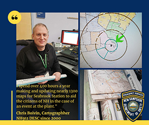
- Maps and GIS Applications for the Seabrook Radiological Emergency Preparedness Program (REP).
- Participation in the Ingestion Exposure Pathway Exercise cycles.
- Maintenance of the DESC's ArcGIS Online Platform and NH Public View Portal.
- Maintenance of the DESC's Internal Public Safety Dispatch Portal, supporting the PSAP and statewide dispatch centers.
- Maintenance of the DESC imagery data, server and services.